FLY SMART, FLY SAFE


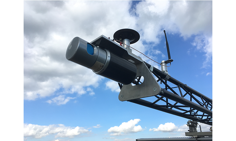
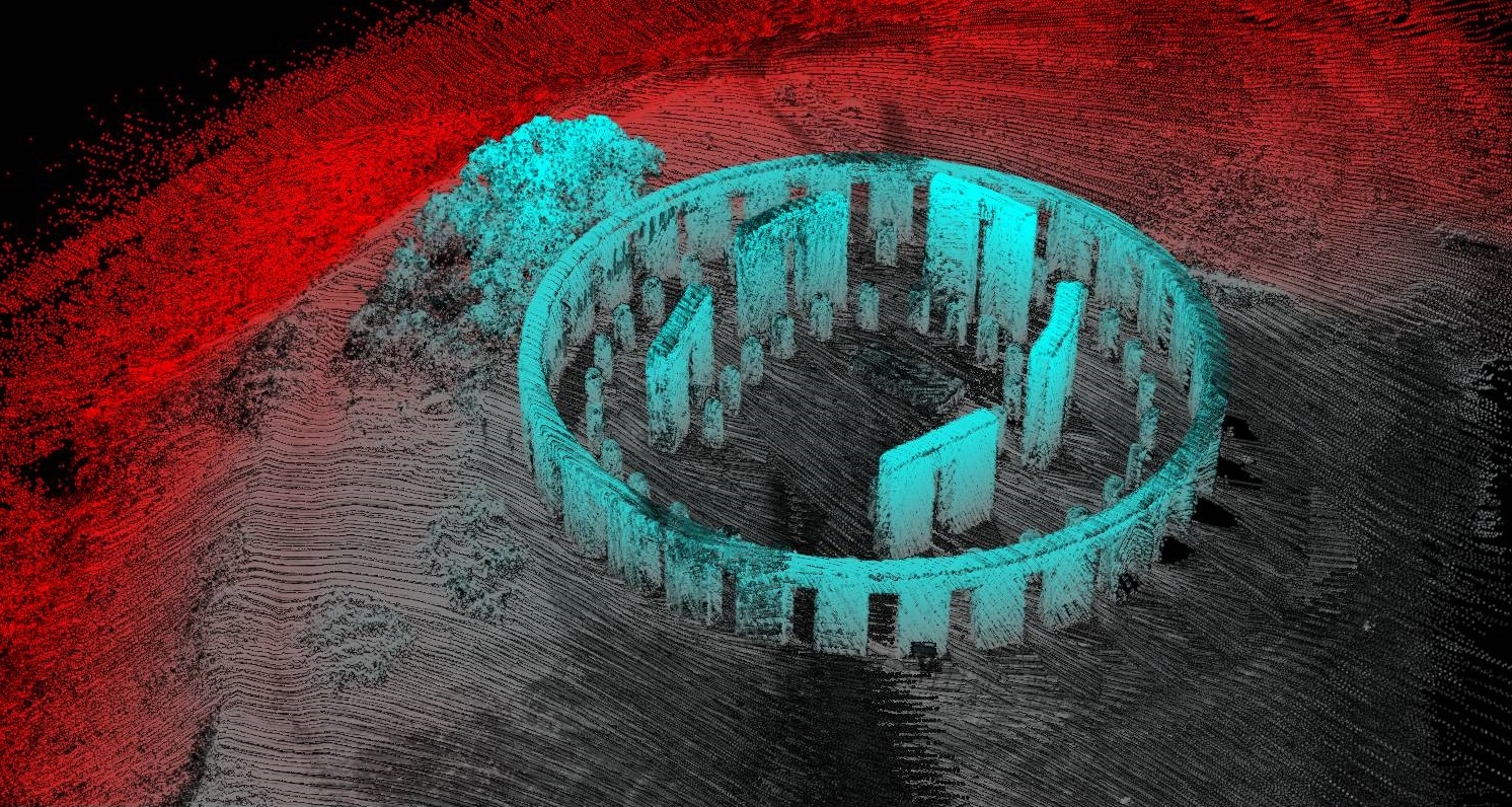
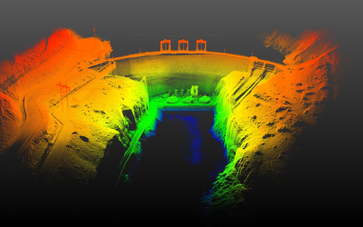
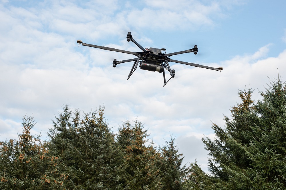
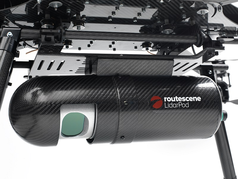
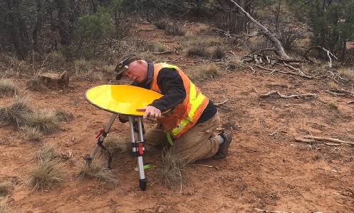
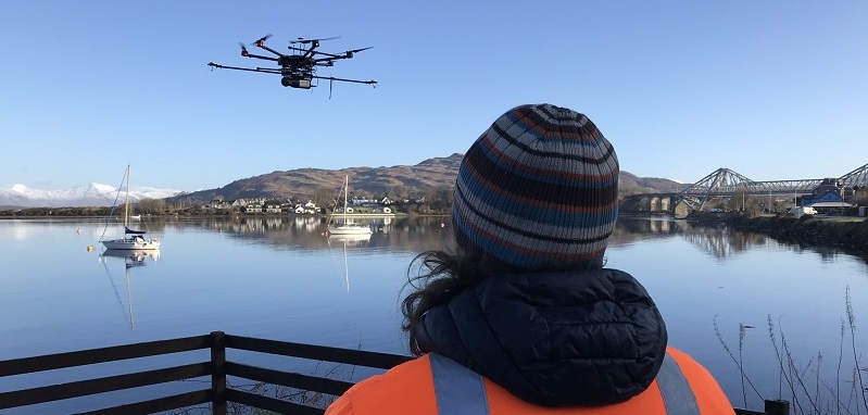
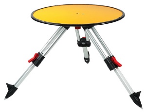
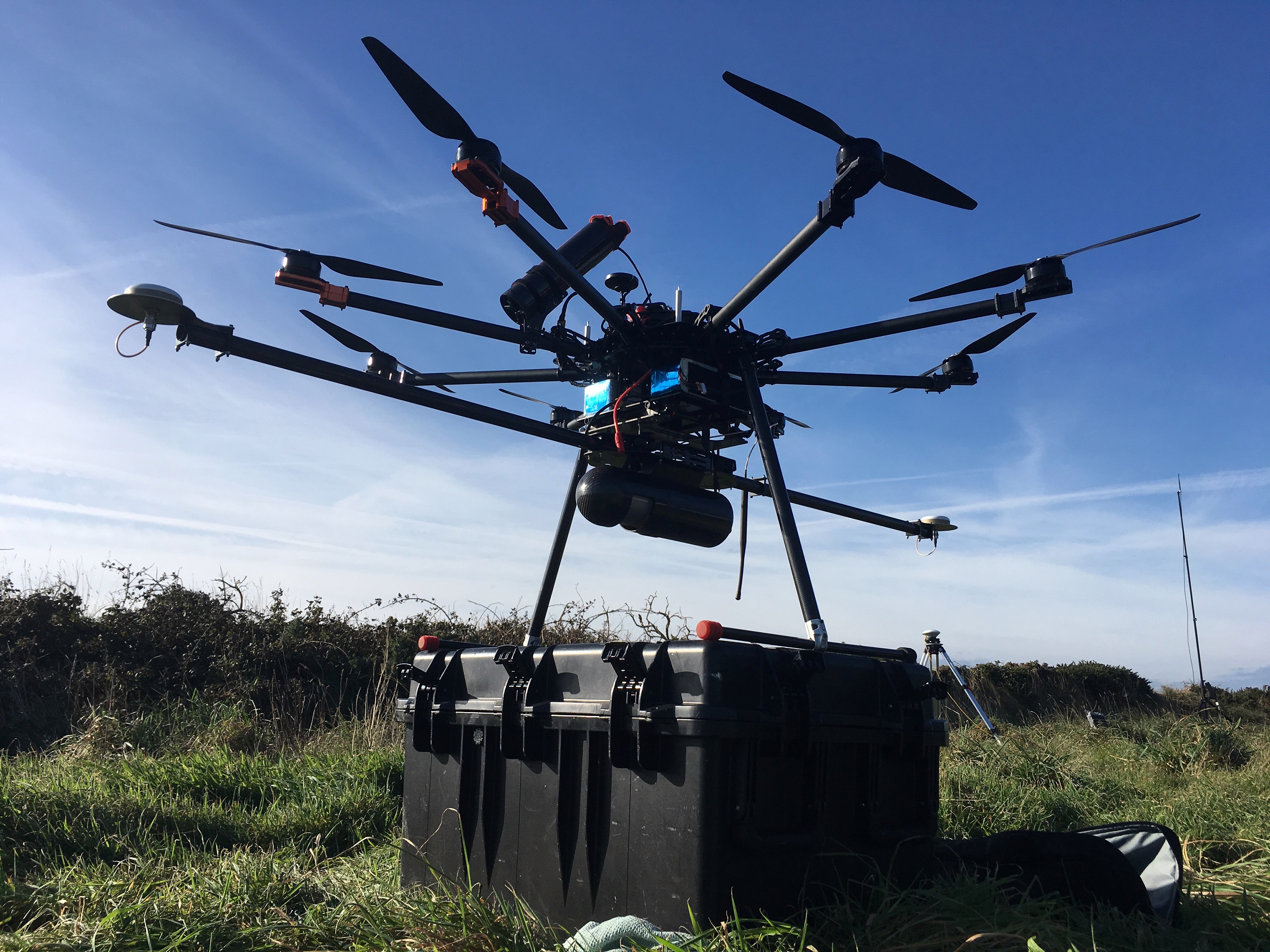
Routescene design, develop and manufacture integrated 3D mapping solutions with LiDAR specifically for use on Unmanned Aerial Vehicles (UAVs). Designed by surveyors, we build survey-grade end-to-end systems to solve specific industry problems, save time, improve efficiencies and productivity. Our integrated system comprises workflow methodologies, software including specific data processing tools, hardware and firmware. Designed to survey sites where accurate mapping is essential but difficult to achieve, the Routescene solution is the perfect system for penetrating dense vegetation, particularly in hard to reach environments where access is difficult or dangerous. Fundamental to the Routescene system is a carefully thought through 6 step workflow – from survey and project planning, data acquisition, data processing to the final outputs or “actionable information”. This workflow is a set of orchestrated and repeatable procedures and processes, so every survey and subsequent data analysis is undertaken in a systematic, streamlined way; ensuring the best possible outcomes each time. Routescene has a strong ethos of Quality Assurance (QA); with foundations in land survey training built upon by many years working in the offshore industry where QA\QC was of paramount importance. As part of the standard QA process, the quality of the data being collected is monitored in real-time in-flight using Routescene's QA Monitor software. Routescene advocate every survey has ground control established, accurately surveying in Ground Control Points (GCP) and placing Routescene LiDAR targets on those points. This prevents unnecessary repeat visits to remote sites. Efficient data processing is crucial. Routescene's proprietary LidarViewer Pro software provides a framework on which to build a LiDAR processing workflow, using the Filter Development Toolkit to develop and apply specific filters to the collected point cloud, to achieve as quickly as possible the most accurate final deliverable. We understand a typical requirement is to maintain the high resolution of the data during analysis, for instance to create a digital terrain model. Examples of filters are sector reduction, laser ID reduction, coordinate conversion, grid creation, our purposebuilt “Bare Earth tool”, a skim grid and an export filter (LAS, LAZ, ASCII). These powerful filters can be set up in an automated sequence or “filter chain” to create repeatable workflows. In step with our automated “Bare Earth tool” you can quickly and cost-effectively remove all non-ground points and reveal the ground surface. This radically reduces the number of software packages and steps in the process and reduces the time you spend post-processing LiDAR data. We provide comprehensive training and customer support as we appreciate from experience working with our customers around the world that achieving optimal results is easier and quicker with in-depth training. This way you achieve a quicker return on your investment. Routescene is based in Edinburgh with a worldwide customer base.
EH6 5QN