Airspace Link announces the official launch of the Operations Center in its flagship product AirHub® Portal. At the core of the Operations Center is its open platform architecture, which integrates with a range of airspace awareness data sources, including crewed aircraft ADS-B detection systems from industry leader uAvionix.
Airspace Link, a leading FAA-approved UAS (Drone) Service Supplier of B4UFLY and LAANC, today announced the official launch of the Operations Center in its flagship product AirHub® Portal. Designed to give organizations real-time operational oversight, the Operations Center enables strategic insight, situational awareness, and live tracking of drone and crewed aircraft activity — all in one powerful system.
“The Operations Center transforms AirHub® Portal into a true command center for organizations managing drone operations at scale,” said Tyler Dicks, Head of Product at Airspace Link. “From public safety teams and federal agencies to state and local governments and commercial enterprises, we’re helping a wide range of users gain the operational clarity they need to deliver safer, smarter, and more coordinated drone operations.”
With the new Operate tab activated in AirHub® Portal, users can visualize:
- Active and planned drone operations for the day
- Live crewed aircraft traffic and uncrewed drone activity, with supporting sensor partner integration
- Current weather conditions across mission areas
- B4UFLY airspace briefings
- [Coming Soon] Real-time telemetry from user organizations’ own connected drone flights
Airspace Link’s new Operations Center in AirHub® Portal delivers a single-pane-of-glass solution for organizations that require coordinated, real-time airspace oversight. Built for flight operations managers, public safety agencies, airfield managers, and state and local authorities, the Operations Center offers a unified, interactive map display that provides a complete common operational picture of all active and planned missions, ensuring safer, more informed, and more efficient decision-making.
Also designed to meet the needs of IT leaders and security professionals, the Operations Center includes robust post-mission analytics, audit trails, and automatic reporting to support regulatory compliance, internal governance, and continuous operational improvement. Critically, Airspace Link safeguards its technology with enterprise-grade security and privacy protocols, backed by SOC 2 and ISO 27001 certifications — ensuring sensitive operational data is protected by industry-leading standards and rigorous best practices.
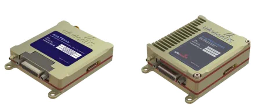
At the core of the Operations Center is its open platform architecture, which integrates with a range of airspace awareness data sources, including crewed aircraft ADS-B detection systems from industry leader uAvionix.
“We’re proud to partner with Airspace Link in delivering high integrity live aircraft traffic data for the Operations Center,” said Cyriel Kronenburg, Vice President for UAS and Aviation Networks from uAvionix, Airspace Link’s trusted sensor partner. “This integration ensures organizations have access to a high quality and accurate view of their surrounding airspace on a single pane of glass — a critical component for safe and effective drone operations.”
Now available for AirHub® Portal organization accounts, the Operations Center joins Airspace Link’s full suite of capabilities – from preflight planning and LAANC authorization to internal operation approvals, crew and asset management, and flight logging. Together, these tools form a comprehensive Drone Operations Management System (DOMS) purpose-built for the needs of modern, connected drone programs.
“Whether you’re overseeing a city-wide drone program or scaling enterprise operations, the Operations Center delivers the situational awareness and accountability today’s teams demand,” Dicks added. “It’s about empowering diverse stakeholders with the tools to operate smarter, safer, and with total confidence.”
As both an FAA-approved UAS Service Supplier of LAANC and B4UFLY, and a provider of advanced drone operations software, Airspace Link offers one of the only fully integrated Drone Operations Management Systems in the market, eliminating the need to manage multiple systems or vendors.
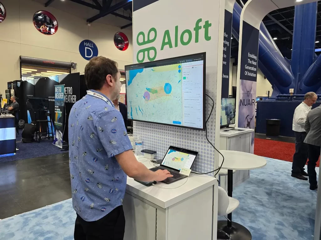
See It Live at XPONENTIAL 2025
Airspace Link will be exhibiting at XPONENTIAL 2025 in Houston. Visit us at Booth #4320 for a live demonstration of the Operations Center and to explore how AirHub® Portal can elevate your organization’s drone operations.
15 May 2025
Read more Member Success Stories & Blogs