SAM IS ....
DfT announce over £20 million to help drones and flying taxis take to UK skies

The UK Government wants the UK to have an advanced aviation ecosystem where everyone can benefit from new technology while tackling emissions. To help it get there, the Department for Transport has announced over an additional £20 million.

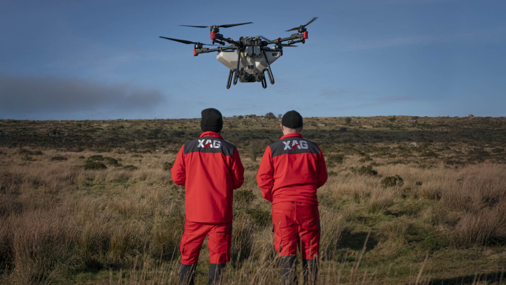
Drone services at a commercial scale and flying taxis could soon be a reality as the Aviation Minister confirms over £20 million funding today (1 April 2025) to launch new flight technologies.  

The new funding will unlock barriers to growth – which is the priority of the Plan for Change – and maximise opportunities for better and cheaper public services while cutting carbon emissions.

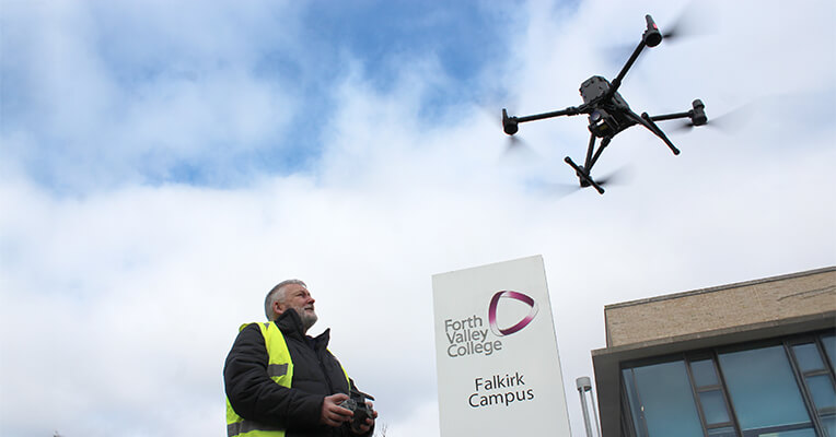
It is designed to advance aviation tech to support healthcare for the NHS, assist police forces in combatting crime, help inspect and survey critical infrastructure and unlock delivery services for businesses and communities across the country.   

As part of this, both the Aviation Minister and Science Minister have today also set out how the Department for Transport (DfT), Civil Aviation Authority (CAA) and the new Regulatory Innovation Office (RIO) in the Department for Science, Innovation and Technology (DSIT) will streamline regulatory processes to support the commercialisation of the industry. 

Aviation Minister, Mike Kane, said:  

I want the UK to have the most advanced aviation technology ecosystem in the world.  

That means creating a nimble regulatory environment and a culture of innovation so everyone can benefit from cutting-edge transport while tackling emissions, traffic and potentially saving lives. 

Our investment alongside the new Future of Flight industry group will bring together tech experts, drone operators, flying vehicle manufacturers and local communities to identify where change needs to happen.

With safety at the heart of these advancements, the RIO is driving smarter regulation to cut red tape while ensuring high safety standards. It will support DfT and CAA in enabling faster, integration of drones and flying taxi industries, helping businesses grow and innovate.

This includes consulting on the mandatory use of new electronic conspicuity standards and technologies, which allow aircraft to share their location electronically, helping drones and crewed aircraft fly safely alongside each other. By making approvals quicker and operations more efficient, this will open new opportunities for the industry while maintaining the highest safety standards.

Science Minister, Lord Vallance, said:

These regulatory reforms for drones – requiring all aircraft to share their location – will make drone operations safer and therefore speed up approvals, allowing them to operate near airports and simplifying their use for delivering medical supplies – while unlocking further commercial opportunities.

This is a practical step to cut red tape and a great piece of progress for the Regulatory Innovation Office, growing the UK’s position as a world leader in emerging technologies and helping drive the growth that will deliver our Plan for Change.

In addition, as previously confirmed by the Chancellor, plans are now underway to simplify regulations to enable 2-year airspace change for drone operations. This will enable operators to fly safely for longer and gather data to inform future services.    

Other changes will simplify regulations to enable emergency services including firefighters and paramedics to use drone services, as well as noise exemptions for drone trials within the Airspace Change Process, and simplifying the drone operational application process to enable them to get flying faster and easier.

Furthermore, the regulator, drone operators, flying vehicle innovators and local authorities will come together with government at the Future of Flight industry group to help guide the government on its mission to transform technology in aviation. 

Part of the government’s Plan for Change, the group will focus on how to unlock the benefits of future aviation technologies to propel the country’s economic growth forward. It will look at how government can harness the potential of technology and create a culture of innovation, with the aim of improving everyday challenges like emergency across the public sector face, while helping cut carbon emissions. 

The Minister for Aviation will co-chair the group, alongside Duncan Walker, CEO of Skyports.

Duncan Walker, CEO of Skyports and Co-Chair of the Future of Flight industry group, said:

This additional government funding is a vital boost for the UK’s leadership in next-generation aviation. This investment will accelerate the development and deployment of innovative flight technologies, from complex drone operations to advanced air mobility solutions. 

I welcome this commitment, which will not only drive progress towards a more sustainable and connected future but also deliver significant economic benefits, high-value jobs and export opportunities across the UK. I look forward to continuing to work in close partnership with government and the regulator to turn these opportunities into reality.

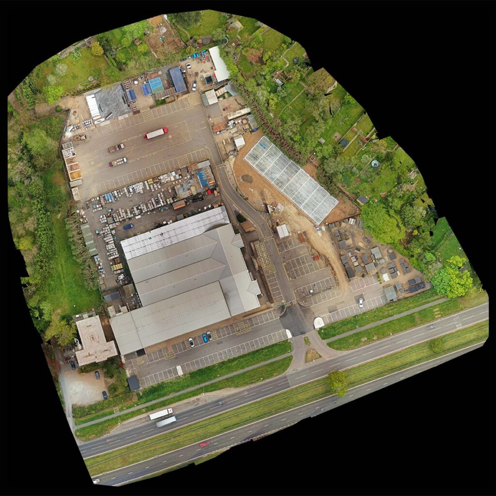
The funding will be divided between the CAA, receiving £16.5 million in 2025 to 2026, to deliver a regulatory programme to enable drones to fly beyond visual line of sight (BVLOS) and progress toward routine use of air taxis (eVTOLs) in UK skies.  

This includes publishing a piloted eVTOL ‘roadmap’, development of ‘drone pathways’ for industry to follow and consulting on concept of operations for uncrewed traffic management (UTM) and Detect and Avoid (DAA) technology. This will make it quicker and easier for industry to prove the safety of these new technologies, deliver the necessary digital infrastructure and make sure that people, property and other aviation remain safe and secure when these new technologies fly in our skies. 

Stuart Simpson, CEO of Vertical Aerospace, said:

Flying taxis will transform the way we move — making it quicker, quieter and cleaner to travel while connecting communities and supporting essential services.

The UK has an incredible opportunity to lead the world in this new era of aviation, delivering not just greener transport but real economic growth and skilled jobs.

This latest funding is another welcome step towards seeing that ambition realised and our world-leading aircraft flying in British skies from 2028.

In addition, the Future Flight Challenge will receive up to £5 million from DfT and Innovate UK, to support industry to turn these new technologies into profitable business that benefits communities and support growth. This will include regional demonstrations and supporting development of commercial drone and air taxi solutions.

Mike Biddle, Executive Director of Net Zero, Innovate UK, said:

Innovate UK is excited to build on the highly successful work of the Future Flight Challenge by working in partnership with DfT through this joint funding. We look forward to working with industry, end-users, DfT, DSIT and the CAA as we accelerate the transition from innovation to commercial operations.

1st April 2025

SAM IS ....
Drone Related Jobs as at 24 March 2025

Disclaimer: All jobs posted here are from LinkedIn and other job sites including member and non-member organizations. Drone related jobs.

Drone related jobs

Skyfarer have multiple roles to fill: Data Analyst, Compliance Assistant, Mechatronics & Software Engineer, Commercial Pilot (Flexi) & Commercial Visual Observer (Flexi).

View here.

sees.ai

Sees.ai are looking to recruit a Senior Technician – Drone Operations.

View Role

Malloy Aeronautics are looking to recruit a UAV Pilot.

View role

Team UAV

Team UAV are looking to recruit a Senior Drone Pilot.

View Role

CAA

The Civil Aviation Authority are looking to recruit a Policy Specialist (RPAS) and a MSA Manager.

Policy Specialist (RPAS)

Market Surveillance Authority Manager

Closing date: Friday 11 April 2025

Prismatic

Prismatic are looking to recruit a Mission Crew Training Lead.

View Role

View other jobs:

24 March 2025

SAM IS ....
Orthomosaic Maps for Construction Sites explained by Carrot Drone Services

Drones are fast becoming an important asset in the construction and building industry. Using orthomosaic maps significant time and money can be saved on all sizes of projects. This article will explain what an orthomosaic map is, what it can be used for and the advantages of using drones to create orthomosaic maps for your project.

Credit to Carrot Drone Services

What is an Orthomosaic Map?

An orthomosaic map perfectly represents an area of land, it is an accurate representation of the geography of the area. They are a bit like satellite images, such as Google Earth, but unlike satellite images the data is totally up to date, the physical representation is far more accurate and the quality is significantly superior.

The orthomosaic map is created by piecing together hundreds if not thousands of separate, but overlapping, photos (orthophotos) taken by drone. Using GPS data that the drone tags each picture with the photographs are then orthorectified to create a geometrically accurate picture of the land.

Normal aerial photos have a perspective view, an orthorectified image is geometrically accurate creating a perfectly straight down view. Orthomosaic maps have no distortion and are to a uniform scale.

The orthorectification process corrects for:

  • Lens distortions
  • Camera tilt
  • Perspective
  • Topographical relief
  • Elevation
Before Orthorectification
After Orthorectification

Orthomosaic maps can be produced quickly, easily and cheaply allowing imaging to be carried out more regularly. Some projects even requiring imaging to be done on a daily basis.

The costs of using a drone operator to create an orthomosaic map are negligible compared to the cost of even the smallest project, especially bearing in mind the savings that up to date data can provide all involved.

Uses of Orthomosaic Maps in Construction

An orthomosaic map allows for accurate measurements to be made of the land and can be used to streamline every stage of a construction project.

Orthomosaic maps can help project teams with:

  • Documenting project progression
  • Improving communication with all agencies involved
  • Dynamic & timely decision making
  • Keeping clients informed of progress
  • Fast & safe site inspections
  • Locating areas of workflow that can be improved & streamlined
  • Observation of hinderences/stoppage
  • Checking conformance to schedule
  • Assessment of quality of work
  • Assessment of stored supplies
  • Asset monitoring
  • Resolving scheduling issues with staff and supplies which may have occurred due to lack of up to date information
  • Dispute resolution
  • Evaluating compliance with appropriate regulations
  • Topographical surveys
  • Locating drainage spots
  • Studying vegetation
  • Studying water ways
  • Optimising grading & earthwork plans
  • Comparing differences from “as built” to the original plans

CAD drawings can be overlayed to check for errors and that drainage and utilities are located correctly.

Drone maps are routinely being used to monitor projects, to keep records and document progress.

Advantages of Orthomosaic Maps

Drone surveying of a site is time-saving, thorough, reliable, clear and can be done inexpensively on a regular basis to ensure the most up to date data is being used.

Traditional methods of site monitoring involved boots on the ground which was inaccurate, incomplete (not all areas being accessible), time consuming and not very regular. Once the survery had been completed the situation would have changed significantly.

Improved Communications

With numerous agencies, from architects, clients, investors, contractors, banks to workers, being involved in construction projects data can be shared quickly and easily. Disparate stakeholders are able to be kept up to date especially when project meetings are taking place virtually. The resultant maps are normally cloud based so easily shared amongst all interested parties.

Quicker & Improved Decision Making

With up to date and accurate information from drone mapping project managers can make quicker and more strategic decisions avoiding costly mistakes, saving time and money and keeping the project on track.

Safety

Aerial mapping is helping contractors spot and assess safety risks and potential hazards where in the past these have been spotted too late avoiding injury and expensive litigation.

Dispute Resolution

As the orthomosaic map represents a complete and up to date picture of the site disputes can be easily resolved or, preferably, avoided. With drone mapping being used to keep documents it is much harder for any parties to dispute issues down the line. Drone maps are increasingly being used in courts to resolve legal cases.

Save Time & Money

Ultimately the use of inexpensive, safe and accurate orthomosaic drone mapping will save time and money allowing all agencies to then concentrate on new profit making projects.

Contractors using drones are able to stay ahead of the competition, winning more clients and maximising profits.

Conclusion

This article explains that if you are in the building/construction industry why you should be considering the regular use of drones in your projects and how they can offer an almost immediate return on investment.

Carrot Drone Services are experienced drone operators having held CAA approval since 2015 and are fully insured.

Please contact us now to discuss how we can help you improve efficiency and drive down costs of your projects. We will carry out your first drone orthomosaic map for free.

Please note that orthomosaic maps are not guaranteed to have survey grade levels of accuracy.

Contact: Carrot Drone Services

Read further articles on:

15 March 2025

SAM IS ....
AutoSpray Systems Secures CAA Approval for BVLOS Agricultural Drone Operations

ARPAS-UK Member, AutoSpray Systems is proud to announce that they have obtained an Operational Authorisation from the UK Civil Aviation Authority (CAA) (received on 11th March 2025) to conduct Beyond Visual Line of Sight (BVLOS) operations in an Atypical Air Environment (AAE). This milestone marks a significant advancement in agricultural drone applications, unlocking new commercial opportunities across multiple sectors.

Expanding Their Capabilities

With this approval, AutoSpray Systems is authorised to operate their 120kg agricultural drone for spraying liquids and spreading granules across agriculture, horticulture, forestry, and many other use cases. Unlike previous restrictions that limited operations to within 500m of the remote pilot, this BVLOS AAE approval allows them to operate without distance limitations, subject to location-specific risk assessment.

Unlocking Commercial Opportunities

Andy Sproson, Director of AutoSpray Systems stated- 

“Historically, our low-level drone operations were restricted by distance regulations, limiting their full potential. With BVLOS approval, we can now reach even more remote and inaccessible areas, making a profound impact in sectors such as:

  • Peatland Restoration – Enabling large-scale reseeding and rehabilitation of degraded peatlands.
  • Paludiculture Crop Seeding – Supporting the cultivation of wetland-adapted crops to enhance biodiversity and carbon sequestration as part of our work with DEFRA, as part of the SEAD Artists consortium.
  • Reforestation Projects – Deploying drones for tree seeding and afforestation in challenging terrains where human access is impractical.

This authorisation significantly expands their ability to scale sustainable land management solutions, reinforcing our commitment to innovation in aerial agriculture.”

Acknowledgments

Achieving BVLOS approval is a testament to the dedication and collaboration of multiple industry and academic experts. We extend our sincere gratitude to the SEAD Artists:

Who are SEAD Artists? This is a consortium of organisations and individuals with the sole aim to become a singular voice and point of contact for the agriculture and environmental industry when they are looking to interact with drones and new technology – speaking with one voice.

It is an initiative that supports an evidence-based data approach to facilitate environment and agriculture which will be as inclusive of all users and operators, and representative bodies as is reasonably possible.

  • Aleks Kowalski – Skypointe Ltd
  • Hasan Hasan and Mohammed Hasan from ITSurveillance
  • Dr Owen McAree from The University of Liverpool
  • Gareth Whatmore and Karina Nasretdinova from DronePrep
  • Abu Hassan from Theory and Practice of Software 
  • Andy Sproson / Robert Pearson and Scott Dowell of AutoSpray Systems 

A special thanks also to the RPAS team at the CAA and all other colleagues involved in shaping the BVLOS AAE policy whosesupport has been instrumental in achieving this milestone.

When can we see this happening? 

Additional information will be released in due course and AutoSpray Systems will be hosting an open day, conducting live demonstration flights week on Monday 28th April 2025, in the Greater Manchester Area.

If you would like to attend, please contact AutoSpray Systems on the contact details below.

For further information, please contact: Andy Sproson
Director, AutoSpray Systems Ltd on [email protected]

20 March 2025

Read more:

SAM IS ....
A New Approach to Regulation by the UK Government

The UK government’s policy paper, A New Approach to Ensure Regulators and Regulation Support Growth, presents a strategic plan to reform the regulatory system to encourage economic growth and private sector investment. The document highlights key challenges such as regulatory complexity, burdensome processes, and excessive risk aversion, all of which can hinder innovation and competitiveness.

One of the primary objectives is to simplify existing regulations, making them more accessible and efficient. By eliminating unnecessary administrative obstacles, the government aims to create a more streamlined regulatory environment that allows businesses to focus on growth rather than bureaucratic compliance. Additionally, the paper emphasizes the importance of reducing uncertainty by providing clearer regulatory frameworks. A more predictable system would encourage investment and foster confidence among businesses.

Another critical aspect of the proposed reform is addressing excessive risk aversion within regulatory bodies. The government seeks to promote a more balanced approach to risk management, ensuring that regulators do not unnecessarily hinder innovation. By fostering a culture that encourages responsible experimentation and new business models, this initiative could unlock new opportunities for various industries.

The proposed regulatory changes could have significant implications for the drone industry. Simplified regulatory processes may lower barriers to entry for businesses and individuals, encouraging greater innovation and adoption of drone technology. Clearer guidelines would also help drone operators navigate compliance requirements more effectively, reducing the likelihood of unintentional violations and promoting safer operations. Moreover, a shift away from excessive caution could lead to more proportionate and practical regulations, allowing drones to be integrated more effectively across sectors such as logistics, agriculture, and public safety.

On drones and autonomous technology:

Building on a number innovative drone trials funded by Future Flight Challenge and the Regulators’ Pioneer Fund – including the partnership launched in July 2024 between Argyll and Bute Council and drone specialists Skyports to explore how drone deliveries can benefit remote businesses and communities – the government and Civil Aviation Authority (CAA) have confirmed the extension of the Apian health bridge trial. This trial uses drones to transport blood from cancer patients at Guy’s Hospital for urgent screening by specialists at St Thomas’s. RIO and DfT have also been working with the CAA to accelerate approvals and to develop metrics to boost transparency in their service to the sector.

In addition, the CAA will enable at least two further and larger scale trial operations by the end of 2025. During 2025, the CAA will also launch an initial implementation of the UK’s Drone Market Surveillance Authority, streamlining the process for companies to manufacture and identify drones that are able to pass required safety criteria, which in turn will simplify commercial operations for many UK businesses.”

Overall, the government’s initiative to modernize regulation presents an opportunity to enhance the UK’s position as a leader in emerging industries, including drones. By addressing regulatory inefficiencies and fostering a more innovation-friendly environment, these reforms could drive economic growth and technological advancement in the years to come.

Read further article about the UK Govt’s review of regulation.

17 March 2025

SAM IS ....
ECITB Drone Training Course offered by First Scottish College

Forth Valley College (FVC) has launched Scotland’s first ECITB Industrial Uncrewed Aircraft Systems (UAS) Operations: Foundation Training Course, marking a significant advancement in industrial drone training. This pioneering five-day program, hosted at FVC’s Falkirk Campus, is designed to enhance drone operation skills for industrial applications, including infrastructure inspections, site surveys, and data capture. ​

Course Development and Industry Collaboration

The course was developed in collaboration with industry leaders, notably Sellafield Ltd, to establish a new standard for uncrewed aircraft operations in complex engineering and construction environments. Amanda Smith, UAV Equipment Programme Lead at Sellafield, emphasized the course’s value: “Having this new standard means if someone comes to us with this ECITB qualification, I understand the standard of the training they’ve got, which saves time on internal assessments.” ​

Course Objectives and Structure

The ECITB Foundation UAS training course aims to bridge the gap between basic drone flying and specialized, high-risk industrial applications. It is ideal for experienced drone pilots transitioning to multi-sector operations or companies seeking to upskill employees. The course equips participants with both theoretical knowledge and practical expertise.

ECITB

Theoretical Modules:

  • Platform: Understanding drone types and capabilities.​
  • Path: Flight planning and navigation.​
  • People: Safety, crew coordination, and risk management.​
  • Procedures: Operational guidelines and compliance.​
  • Planning: Risk assessment and mission preparation.

Practical Training Includes:

  • Precise drone control in varying conditions.
  • Flying near structures safely and effectively.​
  • Capturing high-quality industrial data.​
  • Managing data securely in line with site protocols.​

Upon successful completion, participants receive ECITB Certification, an industry-recognized benchmark for pilot competency. ​

Industry Perspectives

Chris Mann, ECITB’s Director of Learning and Assurance, highlighted the course’s benefits: “The use of drones across industrial settings, particularly for maintenance inspections, offers real benefits to industry, including increased worker safety and efficiency as well as a reduction in asset downtime.” ​

Zak Stark, FVC’s Head of Commercial Training, emphasized the course’s alignment with industry needs: “As industry demand for drone technology continues to grow, this course ensures that companies have access to an industry benchmark for pilot competency and subsequently highly skilled pilots who can meet stringent operational and safety standards.” ​

Role of ARPAS-UK and Pravo Consulting

ARPAS-UK has been instrumental in supporting the safe adoption of drones across various sectors. They have collaborated with specialists to deliver Continuing Professional Development (CPD) sessions relevant to multiple industries.

Pravo Consulting, represented by Philip Hicks, has been involved in preparatory discussions for this inaugural education program. Their collaboration with Graham Brown at ARPAS-UK and Jamie Allan and the team in Scotland has been pivotal in shaping the course to meet industry standards and requirements. ​

Economic Impact of Drone Technology

The integration of drones into industrial operations is projected to have substantial economic benefits. According to PwC’s “Skies Without Limits” report, drones could add £42 billion to the UK GDP by 2030, with 76,000 drones operating in UK skies and a total of 628,000 jobs in the drone-related economy. The report also predicts £3.5 billion in cost savings from drone uptake in the construction and manufacturing sectors. ​

Future Prospects

The launch of the ECITB Industrial UAS Operations: Foundation Training Course at Forth Valley College sets a precedent for drone training in the UK. It addresses the growing demand for skilled drone operators capable of performing complex tasks in industrial environments. As industries continue to adopt drone technology, such training programs will be crucial in ensuring safety, efficiency, and adherence to regulatory standards.​

For more information about the course, interested parties can contact Forth Valley College at [email protected]. ​

In conclusion, the collaboration between Forth Valley College, ECITB, ARPAS-UK, Pravo Consulting, and industry leaders like Sellafield Ltd exemplifies a proactive approach to integrating emerging technologies into industrial practices. This initiative not only enhances the skill set of drone operators but also contributes to the broader goal of modernizing industrial operations through innovative solutions.

Read more:

11 March 2025

SAM IS ....
OfCom & CAA: Making 978 MHz spectrum available for drones

Ofcom has announced a new initiative to make the 978 MHz spectrum available for drone safety devices in the UK. These devices, known as Universal Access Transceivers (UAT), help aircraft identify drones’ locations, ensuring safer integration into airspace. This change is essential for critical infrastructure tasks, such as inspecting power lines and wind turbines.

The 978 MHz spectrum has been shared since 2016 between aeronautical uses and low-power radio microphones for events. From now on, Ofcom will stop licensing this spectrum for outdoor programme-making and special events (PMSE) use, though indoor use will still be allowed. To compensate, new frequencies are being introduced to expand the available spectrum for PMSE, ensuring minimal interference.

This shift in spectrum usage allows for more efficient drone operations while ensuring PMSE users are provided with alternative frequencies.

OfCom and the CAA issued a joint statement in June 2022, with an update March 2025.

This change supports beyond visual line of sight (BVLOS) operations and is part of the Future of Flight action plan and the CAA’s Airspace Modernisation Strategy. Plus: A Supplementary Amendment to Electronic Conspicuity Devices

Read other related posts.

11 March 2025

SAM IS ....
Royal Aeronautical Society RPAAS Conference 23-24 April 2025

In the 2025 RPAAS Conference, experts discuss and explain the obstacles currently hindering progress, exploring practical solutions to overcome them and pave the way for broader integration of drone technology, including:

Location: RAeS HQ, No.4 Hamilton Place, London W1J 7BQ or Virtual

Timing: 8.30am for a 9am start – 5pm

  • How can we achieve cost-effective RPAAS operations without compromising safety, ensuring these safe and effective RPAAS operations remain economically viable for all stakeholders?
  • Examine the crucial question of airspace management and service provision and who bears the financial responsibility within the Air Traffic Management (ATM) framework.
  • Insights into the market outlook, highlighting key issues and barriers and outlining the essential initiatives required to unlock the full potential of drone operations.
  • Future trends and market outlook: Exploring emerging technologies and market trends shaping the future of RPAAS
  • How can we assess the potential economic and societal benefits of RPAAS and eVTOL, and what is their transformative impact on various sectors and the broader community?

View Full Programme

ARPAS-UK Members can access the Corporate Partner rate.

View Further Events

10 March 2025

SAM IS ....
Uncrewed Aircraft Manufacturer Schiebel Selected for UK Police Trials

The UK Police National Police Air Service (NPAS) has selected selected global manufacturer Schiebel to support its most ambitious trial so far of ‘Beyond the Visual Line of Sight’ (BVLOS) uncrewed aircraft operations. The trial – which, in 2024, successfully achieved a place in the Civil Aviation Authority’s (CAA) BVLOS integration sandbox – will evaluate the feasibility of using uncrewed aerial systems (UAS) to work alongside crewed UK Police helicopters and aeroplanes in support of policing operations across England and Wales.

David Walters, NPAS Head of Futures and Innovation, said the aim of the trial was to determine if advancements in aviation technology can bring future benefits to policing and, if they can, how they could be safely introduced into UK airspace. “We will be evaluating how we might integrate uncrewed aircraft into the existing NPAS operating model, under the current management of our CAA-approved Accountable Manager and Form 4 certificate-holders, who are qualified and accountable for the delivery of safe police air operations over England and Wales,”

Schiebel will be flying the CAMCOPTER S-100 in a carefully selected and controlled environment to assess the UAS capabilities, as part of the concept for a future blended fleet, operated by NPAS. “The CAMCOPTER S-100 is being operated worldwide with over 40 customers so far, including the UK Royal Navy. With its unrivalled experience and outstanding capabilities, the S-100 is the ideal UAS for this trial,” said Neil Hunter, Head of Global Sales at Schiebel. “Schiebel prides itself at being at the forefront of delivering UAS technology globally and is continually looking to support the expansion and growth of UAS, specifically in the commercial market. In Western Europe alone it has won contracts with the European Maritime Safety Agency, and with Bristow Group supporting their UK Search and Rescue operations. Being chosen to fulfil this exciting and ground-breaking NPAS trial is testament to the S-100 pedigree and maturity,” he added.

Schiebel will join the National Air Traffic Control Service (NATS) as part of the team supporting the NPAS Futures and Innovation team with the trial, which is funded by the Home Office and scheduled to see its first test flight in summer 2025. After extensive consultation, an area in the Severn estuary, in South West England, has been selected for the trial flights, away from any built-up environments.

For the last 24 months, NPAS has been building a robust safety case, which has included testing a ‘detect and avoid’ solution, to ensure the trial can operate safely and with minimum disruption to the public and other airspace users. Along with the potential capabilities for policing operations, the trial will also evaluate the effectiveness of the ‘detect and avoid’ solution.

We cannot predict the outcome of the trial, but it is imperative we deliver the same, or improved, capability that we have today with our crewed aircraft. The desired outcome is to be able to offer police forces in England and Wales a way of supporting their operations in an even more flexible way, with a continued emphasis on public safety,” added David Walters.

The National Police Air Service was formed in 2012 as part of a collaboration between all police forces in England and Wales to deliver efficient, borderless air support. With an existing fleet of 19 helicopters and four aeroplanes, operating from 15 regional bases, the service responds to around 100 calls for service each day. Air support deployments most commonly range from high-risk missing people and vehicle pursuits to firearms containments, public order and crowd control, intelligence-gathering, counter-terrorism, major incidents and aerial searches.

For more Member Success Stories

7 March 2025

SAM IS ....
Protected: Forestry England : Field Data Collection Services DPS

This content is password protected. To view it please enter your password below: