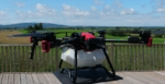
How London Heliport used GuardianUTM Approval Services to improve safety and increase efficiency
Heliport was facing a growing number of drone flight requests. And it was causing problems. London Heliport’s Flight-Restriction Zone (FRZ) encompasses a number of locations: Clapham Common, Battersea Park, Stamford Bridge stadium, HMP Wandsworth, and many more. Unsurprisingly, hundreds of drone operators apply to fly within London Heliport’s FRZ, with the numbers increasing each year….