SAM IS ....
GEOBusiness & Digital Construction Week 2023

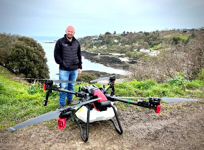
We are thrilled to announce that ARPAS-UK will be exhibiting at GeoBusiness, colocated with Digital Construction, on May 17th and 18th at Stand G650. This event brings together professionals and innovators from the geospatial and construction industries to explore the latest advancements, technologies, and solutions.

We have curated a series of captivating talks and presentations focused on the incredible potential of drones in various applications. These talks, delivered by some of our esteemed members, promise to provide valuable insights and highlight the transformative power of drone technology. Here’s a sneak peek at what you can expect:

GeoBusiness:

1. Aerial excellence: Showcasing the finest projects employing drones for cutting-edge photogrammetry and lidar applications
Speaker: Erick Razon, Richard Dunlop
Date and Time: 17th May 2023 | 10:00 – 10:30 am
Location: Surveying & Mapping Stage
Description: Explore notable global projects that highlight the use of photogrammetry and LiDAR in drone surveying. Discover diverse drone solutions and tactics employed to generate robust geospatial outputs like digital twins, georeferenced point clouds, 3D meshes, and 2D orthophotos.

2. Creating a digital twin with UAV-collected data
Speaker: David McKittrick
Date and Time: 17th May 2023 | 10:30 – 11:00 am
Location: Built Environment Stage
Description: Drones equipped with lidar or cameras enable the creation of digital twins, detailed 3D models of real-world areas. Through photogrammetric processing, GIS analysts can collect data and generate image, point cloud, and mesh layers. Further analysis involves terrain modeling, feature extraction, and overlaying additional data for a comprehensive 3D rendering.

3. Introduction into drones and payload capabilities
Speaker: Adrian Fowler, Brian Critchley
Date and Time: 17th May 2023 | 10:30 – 11:00 am
Location: Surveying & Mapping Stage
Description: This talk provides an overview of drones and their applications for surveying and mapping. It focuses on three drone products: Atmos Marlyn for topographic surveys, Tersus MetaVerse Painter LiDAR for landform monitoring, and Sniffer-4D for air pollutant mapping. Each product is supported by relevant case studies.

4. Infrastructure digital twin & the value of reality modeling
Speaker: Dr. Benoit Fredericque
Date and Time: 17th May 2023 | 2:00 – 2:30 pm
Location: Infrastructure Stage
Description: Infrastructure Digital Twins have revolutionized the way we design, build, and operate infrastructure by breaking information silos and enabling collaboration. This presentation explores the integration of various data sources and discusses the feasibility and benefits of reality modeling techniques through real-world implementation examples.

5. CAA Drone Regulations – What you need to know!
Speaker: James Ixer
Date and Time: 17th May 2023 | 3:30 – 4:00 pm
Location: Surveying & Mapping Stage
Description: This session provides an overview of the updated drone regulations in 2023 and their implications for the geospatial industry. Experts will be available to answer questions and facilitate discussions on drone-related topics.

6. Dr-SUIT – Drone Swarm for unmanned inspection of wind turbines
Speaker: Alex Fraess-Ehrfeld, Victor Becerra
Date and Time: 17th May 2023 | 4:00 – 4:30 pm
Location: Infrastructure Stage
Description: The Dr-SUIT project, a collaboration between Airborne Robotics, Ocean Infinity, Bentley Telecom, and the University of Portsmouth, focuses on using a swarm of drones carried by an uncrewed surface vessel (USV) to inspect offshore wind turbines. The project incorporates real-time scheduling, 5G/satellite communications, and autonomous operations to enhance efficiency and precision in turbine inspection and maintenance.

7. Remote Survey in High Risk Heritage Environments
Speaker: Gary Young, Jon Bedford
Date and Time: 17th May 2023 | 4:00 – 4:30 pm
Location: Built Environment Stage
Description: In this session, Gary and Jon from Historic England will discuss their geospatial work and the integration of semi-autonomous robots and drones into their workflow for accessing hazardous environments. They will highlight the benefits, challenges, and showcase case studies of projects that have utilized these tools.

8. How machine learning, artificial intelligence and advanced analytics are delivering national scale geospatial data and insight for insurers, government, and business
Speaker: Dr. Emma White, Tom Timms
Date and Time: 18th May 2023 | 11:00 – 11:30 am
Location: Built Environment Stage
Description: This presentation discusses the use of Machine Learning (ML), Artificial Intelligence (AI), and advanced analytical techniques for capturing and processing geographic data at a national scale. It addresses the challenges and provides real-world examples of their application in delivering solutions and services to government and the insurance industry.

9. Airborne bathymetry: Surveyors’ insights
Speaker: Andrei Șueran, Maxim Baklykov, Roman Kirsanov
Date and Time: 18th May 2023 | 3:00 – 3:30 pm
Location: Land & Natural Resources Stage
Description: Airborne bathymetry is a new surveying method that can provide bathyorographic maps for reservoirs, rivers, and seas. It allows for large-scale studies with a small team using a drone and offers comparable data accuracy to traditional methods. This method is particularly useful for areas where boat-based surveys are restricted or dangerous. A debate will be held to discuss surveying experiences and techniques.

10. Enhanced insight for environment and security: The cube4envsec initiative
Speaker: Prof. Peter Baumann
Date and Time: 18th May 2023 | 3:00 – 3:30 pm
Location: Main Stage
Description: The NATO SPS project Cube4EnvSec focuses on datacube services for security and climate impact assessment. Demonstrators highlight the integration of satellite, drone, and weather data for applications like aviation safety. The talk provides an overview and live demos of the project’s objectives and achievements.

Digital Construction Week:

1. Deploying drones to support construction teams
Speaker: James Bishop, Varun Sarwal
Date and Time: 17th May 2023 | 10:00 – 10:30 am
Location: Geospatial Theatre
Description: This session explores the practical applications of drone surveying and the integration of drone software into project team workflows. The focus is on improved site works tracking, cost analysis, and validation of early/enabling works using the user-friendly Hammer Missions platform.

2. Building the World’s First Industrial Safetytech Regulatory Sandbox
Speaker: Dr. Helen Balmforth, Seb Corby, Steven Naylor
Date and Time: 17th May 2023 | 10:00 – 10:30 am
Location: Innovation Stage
Description: Discovering Safety, in collaboration with the Safetytech Accelerator and construction industry partners, is establishing the world’s first regulatory sandbox for Industrial Safetytech. This initiative aims to evaluate and test innovative technologies such as AI, visual analytics, drones, and wearables in a simulated environment to promote successful solutions and overcome barriers to adoption in health and safety management.

3. Digital solution for construction – From data acquisition to data analysis using photogrammetry
Speaker: Dimitrios Kalamakis
Date and Time: 17th May 2023 | 10:30 – 11:00 am
Location: Geospatial Theatre
Description: Pix4D offers innovative data capture solutions for construction, including mobile scanning with PIX4Dcatch and an RTK rover for subsurface engineering utilities, as well as drone imagery and the CraneCamera for aerial perspectives. These solutions enhance site management, communication, and cost-saving measures through improved documentation, progress tracking, and BIM model generation.

4. Virtual inspection introduces new approach to operation and maintenance of large structures
Speaker: Dr. Chris Hoy, Richard Jenkins, Sara Peng
Date and Time: 17th May 2023 | 12:30 – 1:00 pm
Location: Asset Management Stage
Description: By leveraging digital technologies like drones, reality capture, and 3D modeling, the transition from manual to virtual inspection of large structures improves their operation, maintenance, and decision-making processes. Complete and geo-referenced structural overviews enable efficient inspection and facilitate informed decision-making through a flexible digital portal.

5. Post-disaster management in smart cities
Speaker: Damla Akyüz, Ezgi Şendil
Date and Time: 18th May 2023 | 10:30 – 11:00 am
Location: Geospatial Theatre
Description: Explore how technology is transforming disaster response in urban areas and how smart cities can utilize advanced technologies to enhance post-disaster management. Gain practical insights for improving disaster response in your community.

6. Taking construction to new heights: The revolutionary impact of drones on UK and global construction companies
Speaker: Ben Sangster, Erick Razon
Date and Time: 18th May 2023 | 11:00 – 11:30 am
Location: Geospatial Theatre
Description: Discover how construction firms are embracing drone technology to enhance efficiency, safety, and transparency in their operations. Explore real-world case studies from industry leaders to learn about successful drone integration in construction digitization.

7. Cintoo Cloud the multimodal as built platform for your static, mobile and drone data that plugs into your digital twin
Speaker: Simon Shaw
Date and Time: 18th May 2023 | 2:00 – 2:15 pm
Location: Tech Stage
Description: Cintoo Cloud is a platform used by leading companies in the AEC and Industry 4.0 sectors to store, manage, and distribute terrestrial, mobile, and drone point cloud data. It enables comparisons between laser scans and 3D models to identify discrepancies, reducing costs and errors. The platform offers benefits such as minimizing site visits, enhancing stakeholder collaboration, and integrating with other digital twin platforms.

8. Bridging the gap between drone surveying and site management
Speaker: Craig Mallard
Date and Time: 18th May 2023 | 3:00 – 3:30 pm
Location: Geospatial Theatre
Description: This session explores the use of drone data in construction, emphasizing the importance of accurate site progress tracking. By combining drones with data analytics platforms, teams can visualize and manage worksites effectively, improving productivity and reducing risks of data silos.

We invite you to visit Stand G650 at GeoBusiness and Digital Construction & to attend these enlightening talks and engage with these experts. Our team will be available throughout the event to discuss our drone-related services, share success stories, and answer any questions you may have.

Don’t miss this opportunity to stay up-to-date with the latest trends and developments in the geospatial and construction industries. We look forward to seeing you at GeoBusiness and Digital Construction on May 17th and 18th!

The ARPAS-UK Team

SAM IS ....
CAP2546: UK CAA Drone tracker survey 2023

Welcome to the eighth wave of the Drone Awareness Tracker! The CAA aims to explore public perceptions and attitudes towards drones, focusing on barriers to registration, awareness of regulations, future uses, and motivating drone owners to register with the CAA.

Objectives:

  1. Identify barriers to registration for drone owners.
  2. Gauge public awareness and attitudes towards drone regulations.
  3. Explore public sentiment on future drone uses.
  4. Motivate drone owners to register through incentives and addressing concerns.

Read more

SAM IS ....
Unmanned Aircraft Uses in Agriculture, inc Spraying and Spreading: WATCH AGAIN

A session exploring the use cases of how drones can work within the agricultural sector, including spraying and spreading from drones.

AutoSpray Systems has the equipment in the UK, and are currently undertaking other testing and seeding/ spraying within traditional agricultural settings. They have the Operational Authorisation from the UK CAA to use Unmanned Aircraft for this use case. Their staff are also a UK CAA Approved Recognised Assessment Entity with over 5 years’ experience and wrote the Operational Safety Case for the CAA, which they accepted and ultimately approved their Operational Authorisation based on this documentation. This is the first authorisation of its kind in the UK.

They have a proven track record of developing a product and developing new marketplaces for these products.

Speaker Info:

Andrew Sproson, Co-owner of AutoSpray Systems

Andrew has a Professional background in the Emergency Services, involving Critical Incident Planning, Search and Rescue Operations and Resource Management.
Andrew has been an Unmanned Aircraft Pilot for over 7 years, and his company has been a CAA Approved Recognised Assessment Entity since 2018.

Andrew is also a qualified Counter Drone Operative and deployed this technology in the field.
Andrew has created Unmanned Aircraft departments in over 300 Organisations and instilled a very high standard of safety.
In 2020, Andrew co-founded AutoSpray Systems and developed the methodologies and risk assessments associated with obtaining an authorisation to spray chemicals with a drone that is over 25Kgs and for Agricultural / Horticultural and Forestry uses.
Andrew has further developed a bespoke training package for Remote Pilots, to adopt these skills and utilise the technology in farming.
Andrew co-wrote the LANTRA approved Chemical Drone Spraying Qualification.

SAM IS ....
NFCC Drones Conference

The NFCC will be holding a conference on the use of Drones in Fire Service operational response on 1st March 2023 at Cranage Hall, Cheshire.

The evening prior to the conference they will host a networking evening where you can come and network with your peers in a relaxed setting and be at the venue ready for the conference the next morning.

Venue:

Cranage Hall
Byley Lane,
Holmes Chapel
CW4 8EW

Date:

28–1 February 2023 (Book By 24th February)

Price:

From £125 + VAT

SAM IS ....
Key milestone for trail-blazing medical drones project as test flights start

Drones carrying key medical supplies are taking to the skies of Northumberland this week as the trial phase of an innovative NHS project gets underway.

Northumbria Healthcare NHS Foundation Trust is partnering with Apian, a company which has come through the NHS Clinical Entrepreneurs Programme, to explore the use of Uncrewed Aerial Vehicles (UAVs) to carry chemotherapy drugs, blood samples and other items between sites.

Following a UK Civil Aviation Authority (CAA) approval process, test flights will be taking place from Monday, February 13, to Friday, May 12, along a route from Wansbeck General Hospital at Ashington up to Alnwick Infirmary and onto Berwick Infirmary.

Given Northumbria Healthcare’s large, predominantly rural patch across Northumberland and North Tyneside, using drones could reduce delivery times, make efficiencies and cut carbon emissions. The trial will collect logistical data and assess the impact on patient experience, staff resources and the environmental benefits.

Sir James Mackey, chief executive of Northumbria Healthcare NHS Foundation Trust, said: “As an innovative and forward-looking organisation, we are always interested to explore initiatives which may be able to improve how we deliver care to our communities.

“With the area we cover and the number of hospitals and other sites we manage, having effective logistics to get supplies where they need to be is vital, while we are always mindful of our need to drive efficiencies and reduce our impact on the environment.

“Using drones has the potential to help us deliver important drugs and supplies in a better, smarter way, so we are looking forward to seeing how the test flights go. We are committed to providing as much care as we can in our outlying communities, so logistical routes to Alnwick and Berwick are a key focus.”

The project will use fully electric aircraft, which can take off and land vertically like a helicopter before flying horizontally like a plane by combining fixed wings with rotors. The UAVs, which are managed by Skyports Drone Services, can carry up to 3kg of payload and have a maximum speed of 110km/h (almost 70mph).

There will be six flights per day at the beginning of the trial, increasing to up to 15 flights per day at the end of the trial, delivering chemotherapy medication to Alnwick and onto Berwick Infirmary. Return flights from Alnwick and Berwick will deliver pathology samples to Wansbeck. Other items that may be delivered include blood packs, prescriptions, medical equipment and mail.

Apian co-founder and medical director, Dr Christopher Law, said: “This trial builds on Apian’s work in the Solent where we flew the world’s first chemotherapy and delivered the UK’s first prescription medicine by drone.

“While there’s still much work to be done before UAVs can operate autonomously in non-segregated airspace, there’s an equal and opposite amount of evidence for Apian to collect for how on-demand delivery can impact healthcare just as it has our personal lives.”

A period of community engagement about this project is taking place alongside the test flights. You can take part in the online survey here – https://survey.alchemer.eu/s3/90531102/Northumbria-drone-trial

This trial is a critical step towards the greater uptake and use of UAVs to support the NHS to build capability into existing, pressured supply chains. Apian, and not the NHS, is funding the trial.

In doing so, there is the opportunity to assess and test the hypothesis that UAVs can deliver critical medical items as efficiently as the internet moves information. This will help reduce costs to the NHS and taxpayer through automation, respond to the climate emergency (a critical undertaking for the world’s fifth largest employer and UK’s biggest single supply chain), create new local employment opportunities, and, crucially, allow for better patient care.

Anthony Cape, Northumberland Estates’ senior asset manager, said: “We wholly support the use of drone technology to revolutionise the delivery of urgent medical supplies, especially in rural communities.

“Northumberland Estates is delighted to have supplied land for hub points in the desired areas, ensuring Apian and Northumbria Healthcare have a flight network for this trial to deliver essential medical services across Northumberland.”

Rowan Brown, CEO of Museums Northumberland, said: “Museums Northumberland is delighted to be supporting this ground-breaking initiative and assisting the work of our outstanding Northumbria Healthcare Trust in achieving better health outcomes for our community.”

There is more information about the trial available in this FAQs section.

SAM IS ....
CAA: Airspace Change Process Consultation CAP1616

The CAA has launched a consultation on proposals to modify the guidance on the regulatory process for airspace change, known as CAP1616.  

On first publication in 2018, the CAA committed to review the CAP1616 process three years after its implementation. The review gives the CAA the opportunity to reflect on the lessons learned and make further improvements to the airspace change process.

You can respond to the consultation at the dedicated website.

The consultation closes on 5 March 2023.

16 January 2023

SAM IS ....
Following milestone first flight Open Skies Cornwall aims to connect remote communities via drones

Open Skies Cornwall achieve milestone first flight in urban environment and invite the Cornish Community to help shape the UK’s first Skyhighways to support the future of Drone Delivery in Cornwall

Ten leading companies and organisations have partnered together to unlock four Cornish airspace environments for the development of the next generation of unmanned aircraft, and to establish a network of ‘Skyhighways’ to connect remote communities for real world end users in Cornwall via drone.

● Open Skies Cornwall consortium have launched their Cornish Community consultation to help shape the UK’s first Skyhighways to support the future of Drone Delivery in Cornwall between 2023-24.

● Project launch event included a milestone flight where project partners achieved the UK’s first urban maritime drone flight in the newly designed Falmouth Harbour Maritime Drone Testbed Airspace Environment which has become the UK’s first Drone Friendly Harbour with a focus on supporting next generation net-zero maritime logistic capabilities.

● As part of the event: Open Skies Cornwall partner Skyports Drone Services successfully showcased the capability of their maritime drone fleet using landing locations sourced by the Drone Delivery Register to help stimulate Falmouth harbour users to sign up to the projects’ ship to shore trials which are scheduled for operation in 2023/24.

● During the launch event at the National Maritime Museum, project lead DronePrep, unveiled the Drone Delivery Register: an online tool designed to showcase how landowners, the public and businesses can help shape Cornwall’s future drone delivery network and to provide an opportunity to suggest landing locations to support lifeline medical delivery and parcel delivery services in the region.

● Consultation responses from the Drone Delivery Register received in January 2023 will enable the Open Skies Cornwall project partners including Skyports Drone Services, Royal Mail, the NHS,  and Falmouth Harbour to use this new mode of transport to form part of their future permanent logistics offering: the £2.4m Open Skies Cornwall R&D funding will allow partners to test, and consult on Skyhighway routes and infrastructure prior to future adoption in 2023-4.

‘Open Skies Cornwall’: A UK Research and Innovation (UKRI) Future Flight Challenge competition winner, has taken off in Cornwall with the aim of using landowner, public and local business feedback to help unlock low-level airspace and enable the roll out of ground infrastructure to support lifeline and commodity deliveries via drone.

The pioneering consortium led by DronePrep, and formed of Falmouth Harbour, Royal Mail, NHS Cornwall and the Isles of Scilly Integrated Care Board, JHUBMED, Cornwall Council, Skyports Drone Services, Neuron Innovations, and University of Southampton are working together to test the next generation of civilian drones, their infrastructure requirements and enabling technology, to serve logistics providers in both public and private sectors across the region.

During the project event at the end of 2022, maritime consortium member Falmouth Harbour and drone operator Skyports Drone Services conducted a live public urban to maritime flight demonstration. The flight between three drone delivery register locations within the Falmouth Harbour Drone Testbed Environment, facilitated by local landowners, provided the public with a first look at how electric cargo could be operated at Falmouth Harbour in the future for ship-to-shore deliveries to provide a more sustainable, efficient logistics service. The event provided a first look at just one of the beneficial services that regular drone services could provide to Cornish communities via the Open Skies Cornwall programme. The flights performed in Falmouth Harbour are a continuation of trials and demonstrations performed in 2021 by DronePrep, Windracers, Skyports Drone Services and Royal Mail  between the mainland and within the Isles of Scilly.

The event also marked the first time that the Drone Delivery Register was used. The DronePrep Drone Delivery Register will allow Royal Mail, NHS, Cornwall Council, Falmouth Harbour users, vessel owners, landowners and businesses to register take-off and landing locations for future drone deliveries, share permission to access land and assets, and allow the project partners to test low-level flight corridors (Skyhighways) with agreement of all ground stakeholders. In the future the register will provide insights into how Cornish Communities can support progress in this innovative sector to support lifeline, medical and commodity deliveries in onshore, island and offshore maritime environments

As part of the Open Skies Cornwall programme, partners will invest £2.4m of UKRI Future Flight Funding into Cornwall to build ground/landing infrastructure, unmanned traffic management sensor networks, commission new unmanned aircraft and establish Skyhighways (drone flying corridors) to support medical and commodity delivery for the NHS, Royal Mail, Cornwall Council, JHUBMED and the multiple users of Falmouth Harbour.

The launch event kicked off the Open Skies Cornwall community consultation and invited the public and businesses across Cornwall to help shape the future of drone logistics in the county by using the Drone Delivery Register to feedback opportunities, interest and concerns

Open Skies Cornwall partner Cornwall Council, who have overseen considerable investment via the Cornwall Aerospace programme including their previous investments in the Lizard Range, Lands End Airport, Isles of Scilly Steamship Group, Windracers and the AeroHUB at Spaceport Cornwall, provided facilitation and representatives from Council portfolio holders and Cornwall Aerospace beneficiary companies, whilst JHUBMED outlined their mission to use ‘red cross’ drone solutions to support their humanitarian response in civilian aid scenarios. Open Skies Cornwall Partners Neuron Innovations and the University of Southampton presented their enabling sensor tech and medical research which will support end users of the Open Skies Cornwall project achieve regular flight in the future.

The event also brought together third party organisations including project managers Mott MacDonald who are supporting the Open Skies Cornwall programme, the Maritime and Coastguard Agency (Search and Rescue) which has recently commissioned £1billion funding for development of their air rescue capability over 10 years, the Civil Aviation Authority Innovation team, who are pioneering regulation via UKRI Future Flight Challenge projects to serve the next generation of air vehicles and Wholeship who have already opened up an area the size of Luxembourg off the coast of Cornwall specifically for the development of civilian autonomous drone and air taxi services.

The public launch of the Open Skies Cornwall consultation and drone delivery register provides an exciting opportunity for project partners, external stakeholders, businesses, regulators, government agencies, the public and landowners to engage together to establish pioneering infrastructure and launch services to support the development of the next generation of aviation and trailblaze a drone delivery skyhighways network which will have legacy for improving healthcare and commodity logistics for the people of Cornwall.

As we enter 2023 it is very exciting to see the Open Skies Cornwall programme taking flight. The First demonstration flight within the Falmouth Harbour Testbed is the first of many pioneering flights in our unique airspace environments; over the next two years we will be using the intelligence gathered from the community via the Drone Delivery Register to plan for meaningful drone deliveries to support maritime, essential healthcare logistics and parcel delivery. I am looking forward to how our technology partners can work with communities to create sky-highways to better connect the region and create a logistics network fit for the 21st century.

Gareth Whatmore – CEO DronePrep & Project Architect – Open Skies Cornwall

SAM IS ....
Altitude Angel and Saab to partner on Digital Tower technology

In a joint announcement made on 5th December 2022, Altitude Angel and Saab have revealed they have formed a partnership that will see Altitude Angel’s market-leading UTM technology platform integrated as part of Saab’s Digital Tower (r-TWR) offering. 

Saab’s r-TWR is a next-generation Digital Tower solution, which builds on proven Saab video processing, visual presentation, and automation solutions. The Saab r-TWR is a flexible and scalable solution for a broad range of use cases and is already deployed for civil and military airports in Sweden, UK, US, and Germany and with implementations ongoing in Belgium, Netherlands, Ireland, and Romania. 

With the formal partnership agreement in place, Altitude Angel will begin integrating its GuardianUTM services into the r-TWR digital tower solution offered by Saab, allowing ANSPs and appropriate stakeholders to digitally authorize and manage uncrewed flights in conjunction with crewed flights, directly communicating authorization, clearance, and in-flight instructions to provide enhanced situational awareness of drone operations. 

Richard Ellis, Altitude Angel, Chief Business Officer, said: “We’ve been working with Saab Tower Systems and Saab (operating the world’s first Digital Tower Centre in Sundsvall, Sweden) for some time and I’m excited to announce the formal partnership agreement. Our partnership with Saab allows us to seamlessly fuse cutting-edge ATM and UTM technologies in one innovative offering reducing time, effort, and complexity for airports, ANSPs, and drone operators to safely carry out operations integrated into the airspace.  

“Through the integration of GuardianUTM, Saab will be able to provide Digital Towers which are equipped and ready for the demands of our future skies, as the use of drones increases and Urban Air Mobility through eVTOL aircraft becomes a day-to-day occurrence.”  

Per Ahl, Saab Digital Air Traffic Solutions, Chief Executive Officer: “In Altitude Angel, Saab can partner with the provider of the leading UTM platform in order to provide our airport and ANSP customers with the greatest and most accurate picture of the sky they manage. In harmony with the capability, the Saab r-TWR gives us, GuardianUTM Enterprise is providing us with key functionalities the future-proof our product for existing and new customers” 

About Altitude Angel:  

Altitude Angel is an award-winning provider of UTM (Unified Traffic Management) software, enabling those planning to operate, or develop UTM/U-Space solutions, to integrate robust data and services with minimum effort quickly. 

Today, Altitude Angel’s market-defining technology is providing a critical, enabling service on which the future of UTM will be built across the globe. Altitude Angel is leading a consortium of businesses to build and develop 165 miles (265km) of ‘drone superhighways’ connecting airspace above Reading, Oxford, Milton Keynes, Cambridge, Coventry, and Rugby over the next two years. The Skyway superhighway network, enabled using Altitude Angel’s ARROW technology, will unlock the huge potential offered by unmanned aerial vehicles and be a catalyst to enable growth in the urban air mobility industry. 

Altitude Angel’s first-party solutions also power some of the world’s leading ANSPs, aviation authorities, and Enterprises, including LVNL (Netherlands) and Avinor (Norway), empowering them with new capabilities to safely manage and integrate drone traffic into national operations. 

From a consistent, well-documented, and standards-based platform, drone manufacturers such as DJI and cutting-edge software developers around the world use our Developer Platform to obtain rich, relevant, and local geofencing data, exchange and share flight plans, de-conflict their own flights in real-time and interface with national flight authorization systems. A growing portfolio of enhanced capabilities helps our customers to comply with current and future regulations and interface with changing national systems with minimal effort. 

By unlocking the potential of drones and helping national aviation authorities, ANSPs, developers, and enterprise organizations, Altitude Angel is establishing new services to support the growth of the drone industry.  

Altitude Angel was founded by Richard Parker in 2014 and is headquartered in Reading, UK.   

Altitude Angel’s developer platform is open and available to all at https://developers.altitudeangel.com 

About GuardianUTM:  

GuardianUTM enables drone manufacturers and software developers to connect into a rich, dynamic source of accurate, authoritative, and relevant information to support geofencing while offering enhanced UTM capabilities such as a single interface to multi-country flight authorization.  

Its companion product, GuardianUTM O/S, supports all the functionality required to deliver national-grade drone traffic management capabilities to any country that wishes to safely unlock the potential of drones.  

Introduction video: https://www.youtube.com/watch?v=Bd0pvUrS07g.  

About Saab:  

Saab serves the global market with world-leading products, services and solutions within military defence and civil security. Saab has operations and employees on all continents around the world. Through innovative, collaborative and pragmatic thinking, Saab develops, adopts and improves new technology to meet customers’ changing needs. 

For further information or to arrange an interview, please contact: 

Stephen Farmer, Altitude Angel, Head of Corporate Communications & PR  
Tel: +44 (0)118 321 4100  
[email protected]  

SAM IS ....
Funding: The Future Flight Skills Challenge. ARPAS-UK welcomes collaboration

Future Flight: Closing the Skills Gap

Competition Opens

Monday 21 November 2022

Competition Closes

Wednesday 1 February 2023 11:00am

Funding Type

Grant

Project Size

Your project’s total grant funding request must be no more than £50,000.

The Future Flight Challenge  for Innovate UK, part of UK Research and Innovation, will invest up to £500,000 in projects to close aviation industry skills gaps.

The aim of this competition is to create and deliver course content and materials that will support skills, talent and training across the future flight sector. The purpose of this is to build awareness of future flight emerging markets and fill key gaps in the UK’s workforce talent and training capabilities.

Projects can deliver one or more of these objectives:

  • schools’ engagement
  • apprenticeships and internships
  • upskilling and reskilling of existing workforce
  • technical courses and vocational training
  • undergraduate, postgraduate and continuing professional development (CPD)

This list is not intended to be exhaustive.

In applying to this competition, you are entering into a competitive process. This competition closes at 11am UK time on the deadline stated.

ARPAS-UK welcomes collaboration on projects for this Challenge

Please contact: [email protected]

Click here to access the Competition Briefing

Click here for more information

ARPAS-UK
Clogworks1-1

SAM IS ....
UK’S FIRST HUB-CENTRIC NETWORK OPEN FOR BUSINESS

UK’S FIRST HUB-CENTRIC NETWORK OPEN FOR BUSINESS

Skyfarer have built the UK’s first functional and operational hub, set in the center of their own hub-centric network being utilized for the Medical Logistics UK Corridor.

WHAT IS A HUB-CENTRIC NETWORK?

Businesses and organisations subscribe to utilise the full capability of the Skyfarer hub and network. As a result, they can turn their use case into a regulated, authorised, and economically advantageous drone operation.

Having a shared service hub means that access to this technology and capability is far more cost-effective whilst not diminishing utilisation. Each hub is being developed to serve a 40km radius connecting each spoke. Whether that be to deliver a product or provide a surveillance solution, the Skyfarer hub contains a drone fleet that is specifically designed and optimised for each operation you are desiring to achieve. 

THE SKYFARER HUB

The heart of the Skyfarer Network of services is the hub, the “home of the drones”. This is a space where the drones are maintained, and operations are run for beyond visual line of sight (BVLOS) sorties.

The purpose of a hub-centric network is to centralize operations. This enables the Skyfarer team to run time-efficient and coherent flights that can be shared amongst end users. Meaning that services can be provided to customers cheaper, quicker and via means that are far more sustainable.

The Skyfarer hub contains a soundproof Operations room, a picking and packing station, an order management station, and a maintenance workshop. It also serves as the headquarters for the Skyfarer team.

The Skyfarer hub-centric network is being used for the first time as part of the ‘Medical Logistics UK Trial’ running from October to January. This trial links 2 hospitals managed by the University Hospitals Coventry and Warwickshire NHS Trust, to the Skyfarer hub and also enables a logistical connection between Coventry and Rugby local communities.

Skyfarer have chosen the West Midlands to set up its first hub due to its centralized location in the UK. This pertains to its history of innovation and technology development.

By 2030, Skyfarer sees a further 20 hubs spread out across the UK, to connect end users by the sky.

Email [email protected] to find out more about Skyfarer.