by ARPAS-UK, in conjunction with Connected Places Catapult
Learn about the practicalities of drone operations and how sensor-based drones can provide benefits to your project
Surveyors, engineers and built environment professionals are faced with a growing portfolio of advanced technology, including drone-enabled sensors. In this online CPD learning session, Michael May, Operation Director at Flythru, will provide an overview of current legislation and what is required in order to bring drones to a project. Michael will also discuss how working practices can be adapted to make it easier to use drones on site, what the challenges and opportunities are for drone-use.
Key Learnings
- Learn what a drone can and cannot do
- Understand how data requirements match platform and operator
About the Speaker
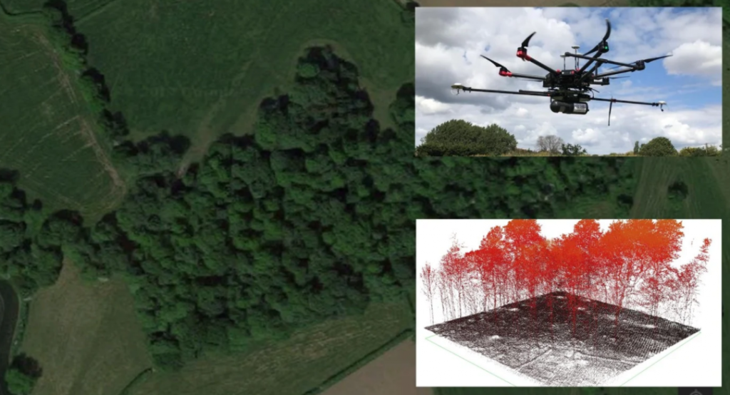
An experienced entrepreneur and qualified pilot, Michael May is a director of Flythru, a company offering 3D mapping, thermal imagery and lidar; providing aerial data in a cost effective and safe fashion.
Professional development series brought to industry by ARPAS-UK, the drone industry trade association and Connected Places Catapult, who provide impartial ‘innovation as a service’ for public bodies, businesses, and infrastructure providers.